Walking
www.adb422006.com

Six walks on Walkingworld.com (click on logo above) are set in Lewis, and are available from the site at ?1.50 each.
3182 - Iolaire Memorial
3424 - Round the Creed
3708 - Tolsta Chaolais to the Carloway Broch
3952 - Waterwheel and War Memorial
5155 - Steinacleit to Ballantrushal
5289 - Around Arnish
A stalkers' track leads from Aline [Ath Linne] on Loch Seaforth northeast to the shore of the loch. It's 4.5 miles or 90 minutes walk, but involves 300 metres or 1,000 feet of ascent. The walks below both lead across virtually trackless terrain, which requires careful navigation. Loch Langabhat is a beautiful loch in a very isolated and remote location, at least 4 miles from the nearest road.
The changeable nature of the weather in the Hebrides is proverbial. It is therefore very important to be prepared.
- Ensure you have an up-to-date forecast
- Be dressed and equipped for any conditions that you can expect to encounter. Don't hesitate to turn back if necessary
- Carry a map, know how to read it and how to use a compass.
- Carry adequate supplies of food and drink.
- Leave word where you are going, and when you expect to return.
- Always report your return to whoever you left word with. A rescue mission could be mounted for you if you don't.
- Do not rely on a mobile phone for calling for help. Coverage is patchy in Lewis and Harris.
- Remember that daylight hours in winter are very limited. Plan accordingly.
- The Harris hills may not rise to great altitudes, but should be treated with respect.
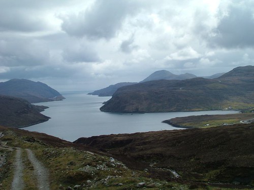
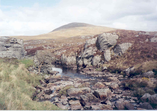
Loch Seaforth seen from the Langabhat track
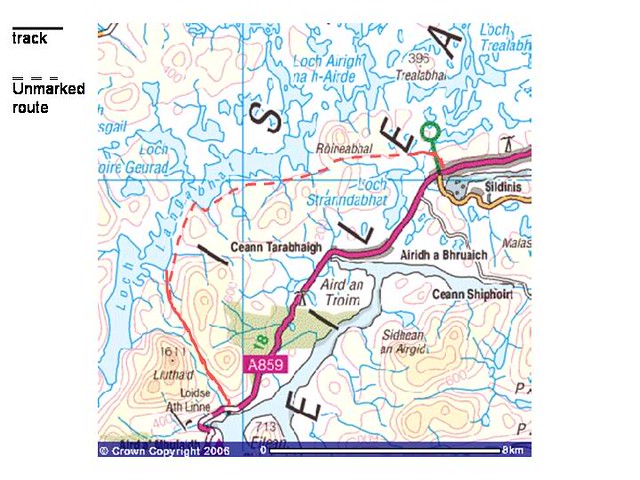
This walk starts in Balallan, at the busstop near the B8060 turnoff. Walk up the farmtrack and make for Roineabhal when the track splits. After fording the Abhainn Mor, head for the pass to the south of Roineabhal. Once there, aim for the shore of Loch Langabhat which you see ahead. Do not descend to the water's edge, but maintain a height of about 50 m and keep to that contour. Walk south along the loch for about 6 km. Do not circle Cleit Faobh to the east, but keep to the shore of the loch. Ignore the valley opening to the east. Head south for 1 km until you encounter the hard track to Aline. This is another 7 km, leading through spectacular mountain scenery and views down Loch Seaforth when descending to the main A859 road.
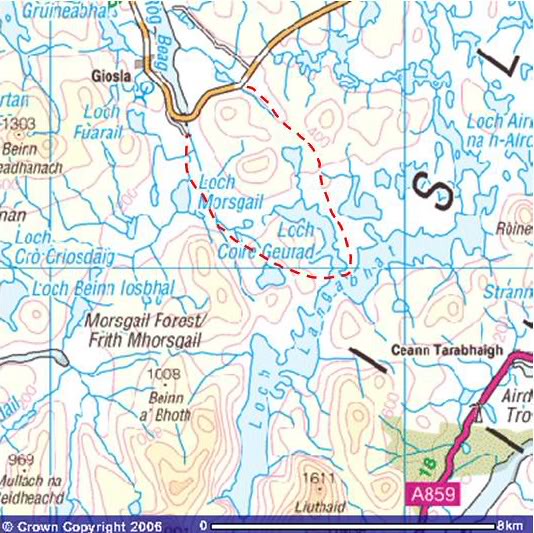
Coltreasal Mor at Morsgail
Start at the track just west of the Scaliscro Road End. This can be muddy after wet conditions. Follow the trail up the valley, then descend from the ridge towards Loch Coire Geurad. Proceed south, all the way to the shore of Loch Langabhat. Cross the outflow of the loch (no major difficulties, except after heavy rain) and walk to the SAA hut. From there, head westnorthwest, to the south of the prominent hill, then towards the northern point of the loch. Continue north across the moors until you encounter a river. Cross this with care and continue northwest, crossing another ridge to the north of Scalabhal. You should end up just outside Morsgail Lodge. Walkers are requested not to approach the lodge, or disturb the occupants. Please close the gate at the top of the Morsgail access road, in order not to allow cattle to wander.